The Bypass: UDOT’s Heber Valley Corridor Live
The county has always kept the bypass at the edge of the North Fields
Since 2000, every Wasatch County bypass plan has kept the road next to Heber City. The County General Plan says to build it “as close to Heber City as possible.” North of 900 North, no county plan puts a road in the North Fields. UDOT itself writes that the North Fields Extension of Route B “would not be consistent with Wasatch County or Heber City plans.” Since 2022, the county’s resolutions and letters ask to protect the fields.
Wasatch County and Heber City endorsed the bypass corridor in 2006 and 2007, and they have acquired right-of-way for it since. The line between 900 North and SR-113 was still open in 2019. That year, the city and the county asked UDOT “to conduct an EIS to identify a final route for corridor preservation.” UDOT now expects its decision in spring 2027.
Sources: DEIS, p. 3-21, p. 1-4, General Plan, quoted in Resolution 22-09, UDOT project page
The county’s record on the North Fields
Most rows are county documents. The scans are the supporting documents that the county sent UDOT with its March 2026 letter, in Volume 2 of the public comments. Other rows cite UDOT’s Draft EIS or the news. Each link opens the page.
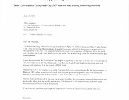
- June 13, 2000
County and city letter to UDOT
“a connection off Highway 40 on the north”
The next page of the scan is its map of the preferred route around the west side of Heber City.
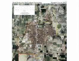
- June 2000
County RPO bypass map
Its West Route runs around the west side of Heber City and back to US-40 at the north edge of town.
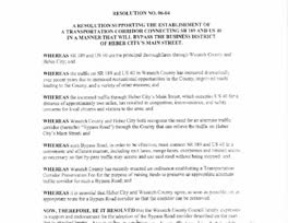
- August 9, 2006
Resolution 06-04
Endorses the bypass corridor.
It asks for a road with “exit lanes, merge lanes, overpasses and limited access as necessary so that by-pass traffic may access and use said road without being stopped”.
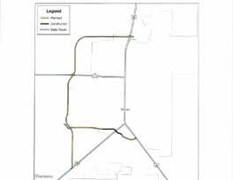
- 2013
County Map 32, “Heber Parkway”
The planned road runs around the west and north sides of Heber City to US-40.
The caption on the scan calls it “Wasatch County General Plan map 20”. UDOT prints this map as the local government preservation corridor (DEIS Figure 1.1-2).
- July 13, 2022
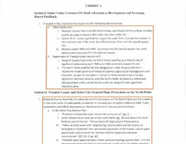
Resolution 22-09, Exhibit A
“the value the community places on the North Fields and the impacts to that area were not adequately considered”
The county wrote this about WB3 and WB4, the 2022 options with a northern extension into the fields. It also wrote that WA1, the early form of Route A, “would significantly impact the water flow of properties located on the south and east of the route”.
- May 15, 2024
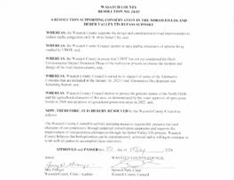
Resolution 24-03
“protect the pristine nature of the North Fields”
It also supports “the improvement of transportation alternatives through the Heber Valley EIS process”, and “some of the Alternative Concepts” in UDOT’s 2023 screening, without saying which.
- March 2026
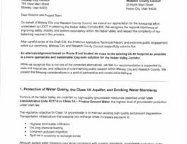
Joint letter, page 1
“An alternate alignment based on Route B but located as close to the existing US-40 footprint as possible”
The letter asks for a realigned Route B, not Route A. Page 3 says that Route B “introduces a new corridor through intact rural and agricultural historic landscapes”. Page 2 says: “We recognize UDOT’s concerns regarding potential historic resource impacts associated with Route A.” UDOT found that the North Fields “do not qualify as a special aquatic site or historic landscape” (DEIS, p. 2-42).
The cards show 7 of the documents. The full record has 12 rows. It adds the 2022 ordinance on Agriculture Protection Areas, the easement vote, UDOT’s findings, and the October 2026 agreement.
Show Every Record and Its Source
| When | Document | What it says about the North Fields | Source |
|---|---|---|---|
| June 13, 2000 | Joint Wasatch County and Heber City letter to UDOT, with a map of the preferred bypass route | The map takes the route around the west side of Heber City. The letter: “The suggested alignment would be a connection off Highway 40 on the north and tying into the South Fields Road area on the south.” | Letter and map for Joint Wasatch County and Heber City letter to UDOT, with a map of the preferred bypass route |
| June 2000 | Wasatch County RPO proposed bypass map | Its “West Route” runs around the west side of Heber City and returns to US-40 at the north edge of town. On the map, it does not go north into the open fields. | Map for Wasatch County RPO proposed bypass map |
| August 9, 2006 | County Resolution 06-04 | The council endorses “the Bypass Road corridor described on the map that is attached hereto.” In the local plans, that corridor runs along the west side of Heber City and ties into US-40 at 900 North. | Resolution for County Resolution 06-04, DEIS, p. 1-4 |
| 2013 | County Map 32, “Heber Parkway” | Printed in 2013. The planned road runs around the west and north sides of Heber City and ties into US-40 at the north edge of town. UDOT prints the same map as its Figure 1.1-2, “Local Government Preservation Corridor”. | Map 32 for County Map 32, “Heber Parkway”, DEIS, p. 1-5 |
| County General Plan | Wasatch County General Plan, as quoted in Resolution 22-09 | On the truck route: “A major impact to the green belt area between Heber City and Midway will be the construction of the Heber City truck route which would allow trucks to bypass Heber City’s Main Street. Care must be taken to see that this road is constructed as close to Heber City as possible.” On the North Fields: “The Central Planning Area (North Fields) is highly prized by many local residents of Heber Valley as open space.” | Exhibit A, p. 2 for Wasatch County General Plan, as quoted in Resolution 22-09 |
| July 13, 2022 | County Resolution 22-09, an official comment to UDOT on the screening | “Wasatch County feels that the value the community places on the North Fields and the impacts to that area were not adequately considered in the selection of options WB3 and WB4.” WB3 and WB4 were the routes across the North Fields. The county also wrote that it “Feels that the North Fields qualifies as a Historic site of significant value and as such WB3 and WB4 adversely impact this site.” UDOT later found that the North Fields “do not qualify as a special aquatic site or historic landscape”. | Resolution and Exhibit A for County Resolution 22-09, an official comment to UDOT on the screening, DEIS, p. 2-42 |
| December 2022 | County ordinance on Agriculture Protection Areas | Lets landowners in the North Fields put their land in Agriculture Protection Areas. It leaves out the land within 100 feet of the centerline of the county’s own bypass corridor. | DEIS Summary, p. S-28 |
| 2023 to 2024 | County vote to fund a conservation easement | The county voted to fund a 165-acre conservation easement in the North Fields. UDOT says the easement “would conflict with all action alternatives”. NRCS later declined to fund it. | DEIS, p. 5-14 |
| May 15, 2024 | County Resolution 24-03 | The council “desires to protect the pristine nature of the North Fields and the agricultural character of this area, as demonstrated by the voter approval of open space bonds in 2018 and adoption of agricultural protection areas in 2022”. The council is also “united in its support of some of the Alternative Concepts” in UDOT’s screening report of January 2023. It does not say which. Two of the five routes in that report, WB3 and WB4, crossed the North Fields. | Resolution for County Resolution 24-03 |
| January 2026 | UDOT’s Draft EIS | UDOT records that “members of the public, Heber City officials, and Wasatch County officials commented that the north fields should be protected, that impacts to the north fields should be used to screen alternatives, or that alternatives extending through the north fields should not be considered because they would result in induced growth or development.” UDOT also writes that the North Fields Extension of Route B “would not be consistent with Wasatch County or Heber City plans.” | DEIS Summary, p. S-27, DEIS, p. 3-21 |
| March 2026 | Joint letter from the County Council, Midway, Heber City officials, the Charleston mayor, and two legislators | “Route B introduces a new corridor through intact rural and agricultural historic landscapes”. And: “A realignment of Route B to run as close as possible to the existing US-40 footprint would substantially reduce these landscape-level effects.” The letter asks for a road based on Route B, at the east edge of the fields next to US-40. It did not ask for Route A. In May 2026, UDOT said that it studies a move of the North Fields section of Route B to the east. | Letter, p. 3 for Joint letter from the County Council, Midway, Heber City officials, the Charleston mayor, and two legislators, Park Record, May 20, 2026 |
| October 2026 | Memorandum of understanding with Heber City, approved by the County Council | The Park Record reports: “Both entities agree that North Fields protections should be in place no matter what route is selected.” Also: “the North Fields will not be included in the city’s annexation boundary.” County councilors expect the Heber City Council to consider the memorandum later. news | Park Record, October 9, 2026 for Memorandum of understanding with Heber City, approved by the County Council |
What the record also shows
- UDOT writes that, if A-20 zoning defines the North Fields, the county corridor would “encroach into the east edge of the north fields between 900 North and SR-113”. Both UDOT routes would too. Route B also “would involve constructing a new road through the north fields between Potter Lane/College Way and 900 North.” DEIS Summary, p. S-27
- Resolution 22-09 also said that WA1, the earlier form of Route A, “would significantly impact the water flow of properties located on the south and east of the route and affect historic flows into the special aquatic site”. The county named that site as “the North Fields, specifically the Provo River corridor”. The resolution named no preferred route. Exhibit A, p. 1
- The March 2026 letter asked for a road based on Route B, “as close to the existing US-40 footprint as possible”. It did not ask for Route A.
The road on the local plans
In the local plans, the bypass runs along the west side of Heber City and ties into US-40 at 900 North. The map shows the line of the 2013 county map with the two UDOT routes.
- Route A
- Route B
- Both routes
- 2013 county map (Map 32)
UDOT writes:
“It is important to note that the local government preservation corridor was identified without any consideration of the abundant wetlands in the northeast segment between 900 North (where the bypass ties into US-40) and SR-113.” DEIS, p. 1-4
In 2019, Heber City and Wasatch County asked UDOT “to conduct an EIS to identify a final route for corridor preservation.” Neither Draft EIS route matches the local corridor exactly. UDOT rates both routes “No” for consistency with local plans. Its note on that table:
“Alternative B includes a North Fields Extension segment, which is not shown in adopted plans. Neither Alternative A nor Alternative B is consistent with the North Village Master Transportation Plan or with corridor access agreements for north US-40.” DEIS, Table 2.4-6, p. 2-39
Between SR-113 and 1300 South, the local preservation corridor is as narrow as 84 feet. UDOT says it “assumes a narrower road than what UDOT has determined is needed.” DEIS, p. 2-18
The timeline
Each item gives its source. A “news” tag marks an item that only a news report supports.
- A first bypass study and design concept, west of Main Street. A 2018 fact sheet lists it. No copy of the study was found. Source for 1998
- Wasatch County Resolution 06-04 endorses a bypass road corridor between US-189 and US-40, on an attached map. DEIS, p. 3-9 for August 9, 2006
- Heber City Resolution 2007-05 endorses the same corridor. Attached to the March 2026 letter. Source for June 21, 2007
- A revised bypass study for UDOT, the Mountainland Association of Governments, Heber City, and the county. DEIS, p. 1-4 for 2008 · 2018 fact sheet for 2008
- A UDOT fact sheet for the Legislature describes a four-lane divided highway with no construction money. Source for January 17, 2018
- County voters approve open space bonds of up to $10 million, 6,916 to 5,050 (57.80%). The Open Lands Board recommends conservation easements, and the County Council approves the spending. The vote count is from the 2018 canvass, attached to the March 2026 letter. Source for November 6, 2018 · Canvass for November 6, 2018
- Heber City and Wasatch County ask UDOT “to conduct an EIS to identify a final route for corridor preservation.” DEIS, p. 1-4 for 2019
- The Federal Highway Administration publishes the Notice of Intent for UDOT. Source for May 11, 2021
- County Resolution 22-09 comments on the screening. It names concerns with three of the routes then in study: WA1, a west bypass with interchanges, and WB3 and WB4 across the North Fields. It names no preferred route. Route A later grew out of WA1 and WB1. Route B grew out of WB3. DEIS, p. 2-41 for July 13, 2022 · DEIS, p. 2-11 for July 13, 2022
- The Heber City Council votes 3 to 1 to ask UDOT to keep all five remaining routes in the study. news Source for March 21, 2023
- UDOT pauses the Draft EIS, in part for two reasons: a proposed federal conservation easement in the North Fields that overlapped all five routes, which the county had voted to fund, and a new regional traffic model. UDOT says the easement, if approved, “would prevent UDOT from proceeding with the EIS.” DEIS, p. 2-3 for 2024 · DEIS, p. 5-14 for 2024
- County Resolution 24-03, “A Resolution Supporting Conservation in the North Fields and Heber Valley EIS Bypass Support”, supports both conservation in the North Fields and the bypass study. It names no route. Attached to the March 2026 letter. Source for May 15, 2024
- A screening addendum names the two routes that the Draft EIS studies: Alternatives A and B. Source for March 27, 2025
- UDOT publishes the Draft EIS and names Route B as its preferred route. Source for January 7, 2026
- Heber City sends UDOT its own letter. It makes eight requests, seven of them design changes, such as moving the 1300 South leg south and direct access to College Way. The letter states no route preference. UDOT comment 206. Source for February 3, 2026
- Before the comment period closes on March 9, Wasatch County, Midway, and other officials send a joint letter that asks UDOT to move Route B as close to US-40 as possible. UDOT comment 689. Source for March 2026
- UDOT posts the public comments on the Draft EIS. Some support Route B, and others oppose it. Source for May 2026
- UDOT tells the Heber City Council that it studies an east shift of Route B in the North Fields. UDOT also says it added a sidewalk and a bike lane through the Midway Lane interchange, and that it will study a move of the 1300 South leg. Both changes answer requests in the Heber City letter (Issues 1 and 6). news Source for May 19, 2026
- UDOT tells the County Council that it got added money from the Transportation Commission to study an adjustment. news Source for July 8, 2026
- UDOT moves the Final EIS and the Record of Decision to spring 2027. news Source for August 4, 2026
- UDOT expects the Final EIS and the Record of Decision in spring 2027. Source for 2027
How the schedule changed
Each row gives the date that UDOT expected for its Final EIS and Record of Decision, when it set that date, and the cause that a source gives for the change.
- In May 2021, UDOT expectedSpring 2023UDOT “anticipates” a Final EIS and Record of Decision “within 24 months in spring 2023.” Source for May 2021
- In January 2026, UDOT expectedSpring or summer 2026The Draft EIS fact sheet gives spring or summer 2026. The DEIS gives two of the causes of the 2024 pause: a proposed federal easement in the North Fields, which the county had voted to fund, and a new traffic model. Source for January 2026 · DEIS, p. 2-3
- In March 2026, UDOT expectedEnd of 2026After the comment period, UDOT expects a Final EIS by the end of 2026. news Source for March 2026
- In August 2026, UDOT expectedSpring 2027UDOT says the added work answers the public comments, which include the March joint letter. news Source for August 2026
How the local requests changed
2022: County Resolution 22-09
The County Council told UDOT that “the value the community places on the North Fields and the impacts to that area were not adequately considered” in its choice of WB3 and WB4, the routes across the North Fields. It also said that WA1, a west bypass with interchanges, would “affect historic flows into the special aquatic site”, which it named as the North Fields. It named no preferred route.
2023: Heber City Council
The council voted 3 to 1 to ask UDOT to keep all five remaining routes in the study. news
2024: County Resolution 24-03
“A Resolution Supporting Conservation in the North Fields and Heber Valley EIS Bypass Support”. The council “desires to protect the pristine nature of the North Fields”. The council is also “united in its support of some of the Alternative Concepts” in UDOT’s screening report of January 2023, and it does not say which. It supports both conservation and the bypass study, and it names no route.
February 2026: Heber City letter
Heber City made eight requests to UDOT, seven of them design changes to the routes. The letter states no route preference. In May 2026, UDOT said it had added a sidewalk and a bike lane at the Midway Lane interchange, and that it would study a move of the 1300 South leg.
March 2026: the joint letter
Wasatch County, Midway, and other officials wrote that “Route B introduces a new corridor through intact rural and agricultural historic landscapes”, and they asked UDOT for “An alternate alignment based on Route B but located as close to the existing US-40 footprint as possible.”
Sources: the resolutions and the joint letter are in Volume 2 of the public comments, as attachments to comment 689. The Heber City letter is comment 206. Resolution 22-09: DEIS, p. 2-41. The 2023 vote: KPCW, March 22, 2023.
This site makes its own case, for Route A, on the case for Route A page, the first page of this section. It speaks for this site only.